|
Friends of Alewife Reservation (FAR) FAR home page |
Search
Events News Image Collections Archive & Links (text, maps, photos) What we do (Volunteer!) About FAR Contact FAR |
|
Wildlife Corridor Blockage Maps added to website December 9, 2010 |
|
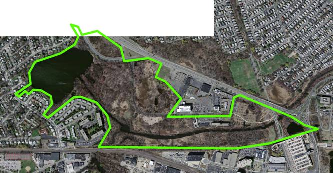
Wildlife Corridor Blockage Maps-Belmont Uplands Text and 4 maps included As human uses encroach on the Alewife Reservation, wildlife are restricted from movement and isolated into smaller populations. The proposed Silver Maple Forest development would fragment the Reservation into three lobes, with tenuous connections between them. This conclusion is based on spatial analysis of the "effective" size of the Alewife Reservation, based in the following outline:
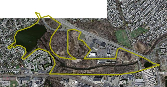
This area, including the marsh north of Acorn Park Drive, could be called the "Greater Alewife Reservation" because light traffic on Acorn Park Drive makes it a fairly insignificant barrier. Development in the Silver Maple Forest would cut into the northern side of the Reservation, leaving the following shape:
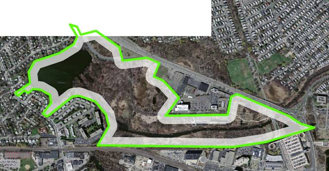
To define "cut off," research on the Flight Initiation Distance (FID) for many wildlife species shows that a distance of 50 meters between humans and wildlife leaves most animals comfortable enough to stay in place; when humans approach closer than 50 meters, animals will begin to flee. When this 50 meter distance is mapped for the current Greater Alewife Reservation, it leaves a single "core" unit without a significant barrier:
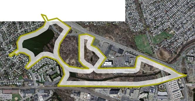
If the Silver Maple Forest is developed, the 50 meter buffer isolates Little Pond and the northern marsh from the Alewife Brook, effectively fragmenting the Greater Alewife Reservation into three lobes:
|